
Florence ZIP Directory Roles
Five verified postal roles shape the Florence ZIP code directory. They do not form five simple neighborhoods. The core code handles much street delivery, another is used for post-office boxes, and the University of North Alabama has an institutional mailing code. The western and eastern Florence postal areas can extend beyond the dense city core and across separate communities.
| ZIP | Areas Covered | Post Office | Notes |
|---|---|---|---|
| 35630 | Downtown and core Florence; City Hall and FLPL | Florence Post Office, 210 N. Seminary | Principal street-delivery code |
| 35631 | City and county mailing boxes | Florence postal system | PO-box mail, not neighborhood geography |
| 35632 | University of North Alabama mail | UNA, One Harrison Plaza | Institutional mail; student box suffix 0001 |
| 35633 | West and northwest Florence postal area; county sites | Facility not verified in research | Postal name extends beyond the core |
| 35634 | East and northeast area; St. Florian and Greenhill | Facility not verified in research | Strong ZIP versus city-limit example |
The table states roles supported by official local evidence, not precise boundary polygons. USPS delivery boundaries change with routes and are not the same as Census ZIP Code Tabulation Areas. Use the postal lookup for delivery and Florence GIS for incorporation.
The roles also set the right starting point for a records search. A 35631 box points first to the agency or person receiving mail. A 35632 address may require the university's own addressing rules. The outer codes demand a parcel and city-boundary check, while the core code still needs a street address before public land records can identify a specific site.
Florence ZIP 35630 Core
ZIP code 35630 is the principal street-delivery code for downtown and core Florence. City Hall and Florence-Lauderdale Public Library use it. The USPS Florence Post Office listing identifies the office at 210 N. Seminary Street, with retail hours from 8:30 a.m. to 5 p.m. Monday through Friday and 8:30 a.m. to noon Saturday.
The official USPS listing shows the service point used in this Florence ZIP code directory.
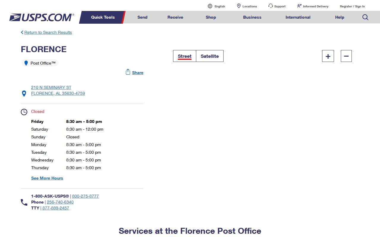
The screenshot supports the office location and hours, but it does not draw a full delivery boundary or identify residents. A 35630 result should still be narrowed to a street and parcel before drawing any conclusion about an address.
Note: A USPS city name supports mail delivery and does not by itself establish municipal tax, voting, zoning, or permit jurisdiction.
Florence Box and Campus ZIPs
ZIP code 35631 is used for Florence city and county mailing boxes. It should not be plotted as a residential neighborhood. A PO-box address tells where mail is collected, not where the recipient lives or where a parcel sits. Searchers who only know 35631 need a name, agency, box number, or document reference before moving to a public record.
ZIP code 35632 is the University of North Alabama institutional mail zone. The UNA address instructions give One Harrison Plaza for university mail and identify a student box suffix. They also show a striking local split: east-campus large deliveries use a physical Tune Avenue address with 35630.
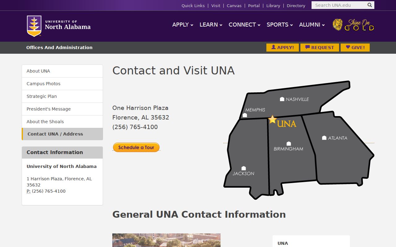
The campus screenshot demonstrates why a single institution can use different postal treatments for box mail and physical freight. It is the clearest Florence example of mailing address versus situs, meaning the place where a building or parcel physically sits.
Florence ZIPs Beyond Downtown
ZIP code 35633 covers west and northwest Florence postal territory and some county sites. Research did not establish a single official facility or exact boundary. ZIP code 35634 serves east and northeast Florence addresses while also appearing in St. Florian and Greenhill. That overlap makes 35634 the strongest warning against equating “Florence” on an envelope with incorporation.
Official city recycling-location evidence places county schools and offices under Florence 35633. It places Rogers High and Greenhill in 35634 and also treats St. Florian as a separate place. These are postal clues, not proof that every point receives Florence municipal services.
A resident search across 35633 or 35634 should therefore test each address. Turn on the Municipal Boundary layer in Florence GIS, select the parcel, and note which precinct, zoning, historic, and county land-record layers apply. The ZIP code directory narrows the field; the boundary map resolves jurisdiction.
Search Florence Residents by ZIP
No official Florence portal offers a dependable public ZIP-wide household list. A careful Florence ZIP code search uses postal geography to narrow a lawful public-record task, then switches to the tool that holds the needed fact. The voter personal lookup is identity-gated, and City GIS publishes no ZIP layer.
- Confirm the address and postal code with the USPS lookup. For box or campus mail, separate the mailing point from the physical site.
- Open Florence GIS and test the physical address against the municipal boundary and Lauderdale land-record parcel layer.
- Use the Revenue Commissioner’s state-linked property search for an owner, address, or parcel. Record situs and mailing fields separately.
- For a defined lawful voter-data need, use the Secretary of State request form and specify city, county, district, status, and selected fields. Do not expect My Voter Page to browse a whole ZIP.
- Once the code is reduced to an address, use the Florence street directory workflow for parcel-by-parcel work.
A broad postal code can cross jurisdictions and contain many unrelated address types. The sequence keeps the search tied to an actual source and avoids implying that a ZIP record proves current occupancy.
Florence ZIP Search Fields
Research captured no verified ZIP field in the Lauderdale appraisal interface. The documented assessor routes use owner name, situs address, parcel number, and possibly a numeric property account. Those fields are still useful after a ZIP has narrowed the general part of Florence.
| Field | Type | Required | Use |
|---|---|---|---|
| Name | Text | No | Owner surname or business; try spelling variants |
| Address | Text | No | Physical property or situs address, not owner mail |
| Parcel Number | Text | No | County parcel identifier |
| PPIN or account | Text | No | Numeric property account when exposed |
| Search / Reset | Buttons | Not applicable | Run or clear the query |
The City GIS Address Search, Select, Query, and Data Layers tools then add map context. Its municipal boundary can answer whether the parcel is in Florence. The assessor’s owner mail block cannot answer that question by itself.
Florence ZIPs Versus City Limits
Florence postal geography, city limits, planning jurisdiction, voting precincts, and parcel boundaries are separate systems. The building department’s planning reach extends three miles beyond city limits but excludes named municipalities and communities. That service area is not a ZIP code. Census ZCTAs are statistical approximations, not live USPS delivery lines.
The permit exclusions are Center Star, Greenhill, Killen, Lexington, Rogersville, St. Florian, and Waterloo. This matters most in the outer Florence postal codes, where a mailing label may sit near one of those places. The city forms hub also includes an E-911 or address-assignment form, but research did not recover its fields or a city numbering-grid rule. Use the issued address rather than inventing one from a nearby ZIP.
- ZIP code
- A USPS routing code for mail delivery, not a legal municipal boundary.
- ZIP+4
- A more precise delivery segment added to the five-digit code, often identifying a block, building, box group, or institutional unit.
- PO-box ZIP
- A code used chiefly for post-office boxes rather than a mapped residential district.
- Unique ZIP
- A code assigned to a large organization or institution with enough mail to justify separate handling.
- Carrier route
- A USPS delivery path that can cut across common neighborhood names and is not a resident roll.
Boundary check. A Florence ZIP code never proves that an address is inside Florence. Verify delivery with USPS and incorporation with the municipal boundary layer.
ZIP Is Not Parcel Identity
Land records need identifiers that survive postal changes. Lauderdale parcels use TMS and map, block, and parcel fields. Subdivision property may use lot, block, and plat, while metes-and-bounds descriptions define land through surveyed calls. A deed is indexed by parties and recording references, not reliably by modern ZIP.
This distinction matters when an address name changes. Wood Avenue was formerly Market Street. Old directory or deed work may need the legal description, intersection, plat, or historic map geometry to bridge the names. A ZIP code directory cannot make that historical connection on its own.
Start with the current situs, save the parcel identifiers, and carry them into the Probate search. If the online index ends, use the courthouse counter with the party name, approximate year, instrument or book-page citation, and legal description. No official online deed cutoff was verified, so it should never be guessed.
The same care applies to voter and permit records. Registration geography follows election administration, while Florence's permit jurisdiction can reach past incorporation and excludes named nearby places. Neither should be sorted into a resident list solely from the postal code. The code is a routing clue; the custodian's own geographic field controls the record.
Florence Growth and ZIP Clues
Florence grew from 40,184 people in the 2020 census to an estimated 42,581 in 2025, a 6.0 percent rise. Those citywide figures provide useful context but cannot be divided among the five postal roles without a verified per-ZIP source. Research found no authoritative current population count for each code.
Growth also changes the relationship between new development, routes, and civic boundaries. The late-nineteenth-century city core, UNA, later western and eastern areas, and nearby communities do not fit into one clean postal hierarchy. County facilities and schools may also carry a Florence postal name without joining the city. The sound method is still address first, parcel second, city boundary third.
Note: Do not substitute Census ZCTA totals for USPS delivery coverage unless the statistical approximation is clearly labeled and suits the question.