
Florence Neighbor Sources by Block
A block lookup combines records that answer different questions. Florence GIS is the best starting point because it shows parcel shapes and adjacency. The Revenue Commissioner supplies assessment data, Probate holds transfers, the Secretary of State handles voter-list extracts, and historical maps preserve earlier block form. None is a live household roster.
| Source | What It Shows About a Block | Access |
|---|---|---|
| Florence GIS parcel layer | Touching parcels, owner, situs, mailing components, acreage and value | Free online map after disclaimer |
| Municipal, precinct and zoning layers | City status and boundaries that may change across a street | Free map; no resident names |
| Probate deeds | Transfer parties, recording references and legal descriptions | Vendor portal and courthouse counter |
| Alabama voter list | Lawfully selected registration fields for defined geography | Paid SOS request; protections apply |
| Sanborn maps | Historic building-by-building block form in 1889 and 1921 | Free Library of Congress images |
| Civic boards and groups | Published officers, appointees and organization contacts | Public city or group pages; no household roster |
Owner names can identify who holds title, not who sleeps at the address. Renters, relatives, roommates, and other occupants may be absent. Even a matching owner mailing address supports possible owner occupancy rather than proving current presence.
Map Florence Neighbors Parcel by Parcel
The Florence Online Mapping Portal provides Address Search, Select, Query, Measure, Print, Legend, Data Layers, Bookmark, and Basemap tools. It does not advertise a neighbor-radius or buffer search. The exact method is visual and parcel based.
The zoning layer is updated on the first and third Wednesdays of each month. That published schedule makes it useful for current civic context, while also warning that a saved map can age. The parcel service exposes owner, situs, mailing, and map-block-parcel fields and caps a service query at 2,000 records.
- Enter the known street address and enable the Lauderdale County land-record layer.
- Zoom until parcel boundaries are clear. Select the subject polygon, then each touching or nearby polygon.
- Record owner name, situs address, mailing components, TMS, map-block-parcel, acreage, and property links for each selected lot.
- Use Measure for an informal distance or Query for a common attribute. Do not label either action an official neighbor-radius search.
- Compare the Revenue property card or Probate deed when a name, tax year, or transfer needs confirmation.
The compact flow is address → parcel → touching parcels → owner fields → assessment or deed. For every parcel along a whole named road, switch to the Florence street directory method rather than stretching a block lookup beyond its purpose.
Reading Florence Neighbor Owner Fields
The GIS schema exposes owner name, `addr_site`, separate owner mailing components, TMS, map/block/parcel, district, calculated acreage, building value, and property links. Situs is the physical land address. Mailing fields show where the assessment notice goes. A difference may point to an estate, company, agent, absentee owner, or another valid mail choice.
Florence neighbor research must also account for the October 1 tax-year rule. A tax notice issued after a sale may retain the prior owner for that assessment year. When the roll and current transfer disagree, compare the tax year with the deed recording date and ask the Revenue Commissioner which year is displayed.
- Parcel
- A mapped unit of land identified by county record fields.
- Situs
- The physical property address, distinct from owner correspondence.
- TMS
- A county tax-map identifier used to keep the same land tied to its record.
- Legal description
- The lot-block-plat or surveyed description that controls the land identity when street labels change.
Note: Parcel ownership does not identify utility customers, private membership, every adult at an address, or anyone protected from public disclosure.
Florence Neighbor Districts Differ
Florence planning materials name West Florence, North Florence/Pine Street, East Florence/Sweetwater, River Heritage, Cox Creek/Gresham-Middle, Midtown, and Downtown. These labels help organize projects and geography. Research found no official umbrella neighborhood-association or HOA member directory for the city.
| Place or Group | Public Evidence | What Is Not Established |
|---|---|---|
| West Florence | Adopted neighborhood plan | Resident association or member list |
| North Florence / Pine Street | Adopted specific plan and project contacts | Household roster |
| East Florence / Sweetwater | Specific planning material | Association membership |
| River Heritage | Priority planning identity | Private resident list |
| Cox Creek / Gresham-Middle | Priority overlay | Civic membership |
| Downtown | Public Main Street and civic contacts | Neighbor directory |
A planning district, historic district, HOA, civic club, council district, and postal neighborhood can overlap. Never infer that a Florence address makes its occupants members of a group. Use a public boundary as geography and only use officers or contacts that the organization itself publishes.
The community layer still has value. An adopted plan can explain why two sides of one street face different projects or zoning questions. A public board roster can identify the right city contact. What it cannot do is turn a project boundary into consent to publish, contact, or classify every person who lives within it.
Historic Florence Neighbor Blocks
The Florence historic-district inventory identifies named areas that add context to a block. Sannoner, for example, documents 25 structures on North Court and North Pine. A district designation describes buildings and place; it does not list Florence neighbors.
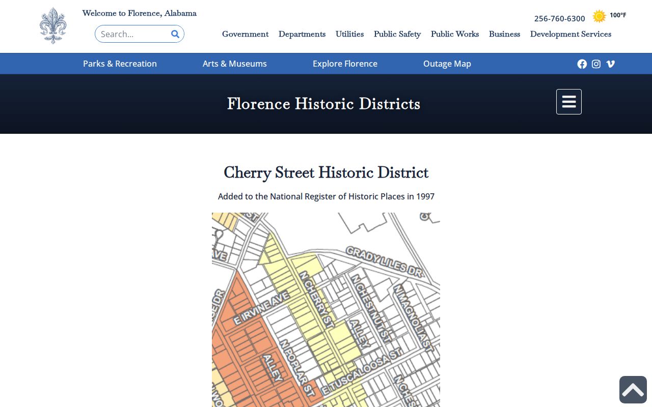
The captured city page supports the historic-area names used for local geography. Current household identity still comes from a separate lawful record, and a landmark history should not be converted into a resident claim.
For deeper block history, the 1889 Sanborn atlas has six sheets while the 1921 atlas has 41. Those maps show building footprint, material, use, house or block number, and street layout. They do not name occupants. Pair a sheet with a same-era directory or deed when reconstructing a past block.
Florence Neighbor Civic Contacts
The City of Florence contact directory is an official people directory of public staff names, titles, offices, and direct phone numbers. It can route questions about planning, permits, police records, licensing, and municipal records. It does not expose private neighborhood membership.
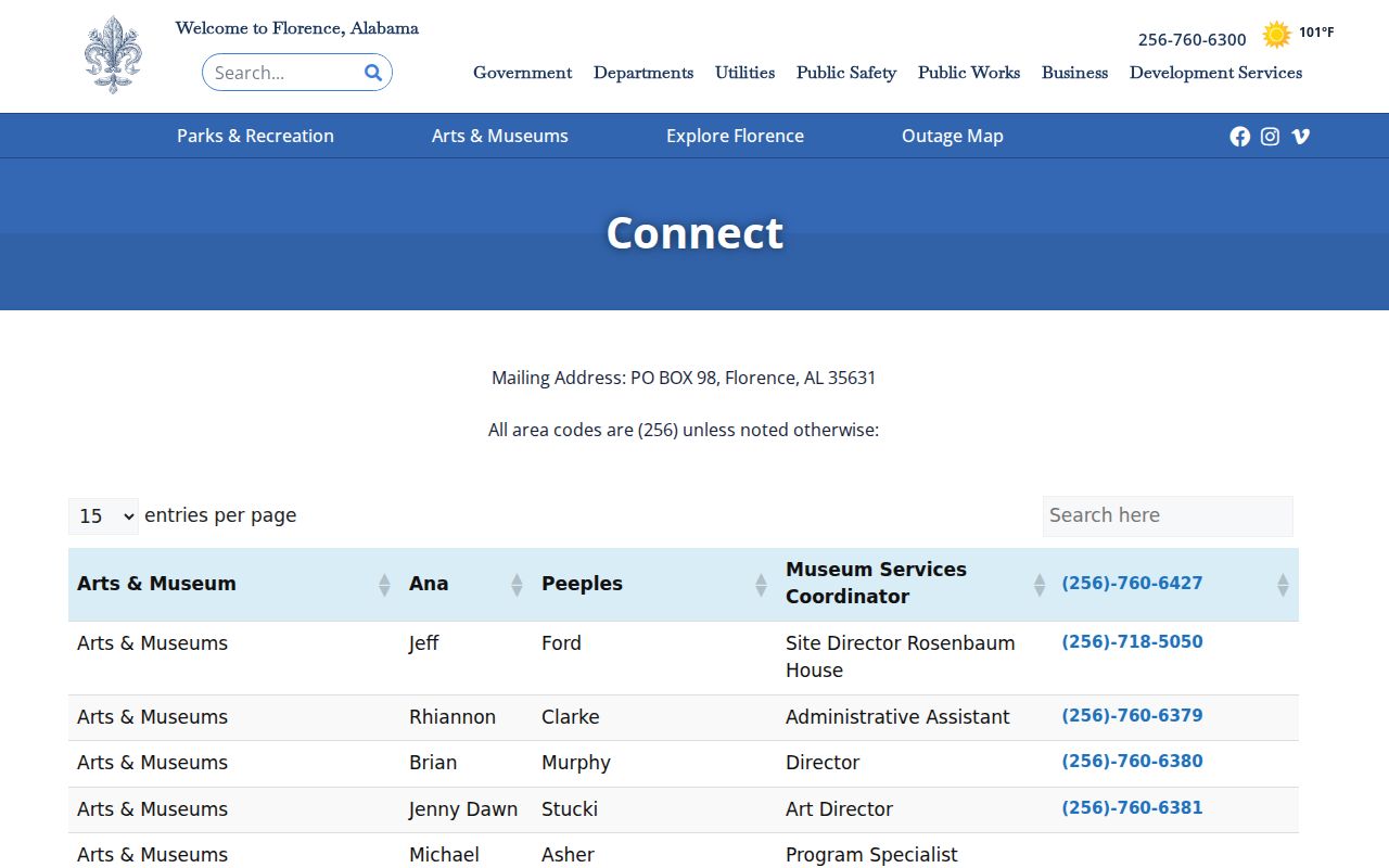
The screenshot illustrates the difference between public organizational contacts and block residents. City boards also publish appointees, and Downtown organizations or civic clubs may publish officers. Those names describe public or voluntary roles only.
Planning and GIS
Use city planning pages for adopted district plans, public project contacts, and mapped municipal, zoning, precinct, or historic layers.
Revenue Commissioner
Ask the county custodian about the assessment year, owner fields, exemptions, parcel identifiers, or corrections to the tax record.
Probate Judge
Use the land index or courthouse counter for deeds, plats, transfers, and legal descriptions tied to a block parcel.
Florence Neighbor Voter Data
My Voter Page verifies a voter’s own registration, polling place, and ballot status after identity inputs. It is not a public browse-by-street tool. A precinct layer in Florence GIS also shows only election geography. It contains no resident names.
Under Ala. Code §17-4-38, a lawful researcher can request selected statewide voter-system data from the Secretary of State for a county, city, or district. The form permits active, inactive, or both statuses; selected columns; and paper or electronic formats. Stated fees are $0.01 per voter electronically, $1 per paper page, and $5 for certification. Protected identifiers are omitted.
Some qualifying residents may suppress residential and mailing addresses through voter affirmations, including a domestic-violence process under Ala. Admin. Code r. 820-2-2-.26. A missing name or address is therefore not proof that no one lives on the block. Registration addresses can also lag real moves.
List maintenance adds another timing issue. NCOA matching, returned notices, and nonresponse can move a registrant to inactive status before statutory removal. Conversely, a registration address can remain after a real-world move. Read status and address as election records tied to a date, never as a door-by-door census of Florence neighbors.
Florence Neighbor Tools Compared
Official rolls and commercial neighbor tools solve different problems. The former identify a custodian, record purpose, and correction route. The latter compile many sources and may merge names or preserve old addresses. Neither should be described as a complete current household list.
| Feature | Official Florence or Alabama Record | Commercial Compilation |
|---|---|---|
| Source | Named public custodian | Mixed public and licensed feeds |
| Meaning | Limited to the roll’s legal purpose | Labels may blend owner, relative, or past address |
| Timing | Known tax year, filing date, or update cycle where stated | Refresh date may be unclear |
| Correction | Request correction from the source office | Use the provider’s privacy or correction process |
| Best use | Confirming a specific parcel, filing, registration, or boundary | Finding a lead that still needs official confirmation |
Start with GIS when the question is “which lots touch this address?” Start with the custodian when the question is about title, assessment, or voter status. A compiler’s convenient block display cannot change what the underlying evidence proves.
Privacy for Florence Neighbors
Private membership, utility accounts, delivery data, renters, roommates, and household relationships stay outside the parcel map. Federal law restricts motor-vehicle personal information. Protected voter addresses, sealed court material, and nonpublic group rosters are not gaps to work around.
Alabama’s Personal Data Protection Act was enacted in 2026, but its access, deletion, and opt-out rights do not begin until May 1, 2027. Even then, public-record and regulated-data exemptions mean it will not erase a lawful deed, assessment, or voter source. A current commercial opt-out only suppresses that compiler’s display.
Lawful use. Florence neighbor lookups support civic curiosity, block history, and personal safety awareness. Never use public data to watch, harass, threaten, or harm another person.
Florence neighbors should be approached as people, not data points. A map may help identify the right public record or civic contact, but direct, respectful contact with clear consent remains the only sound and fair way to learn what a record does not state.